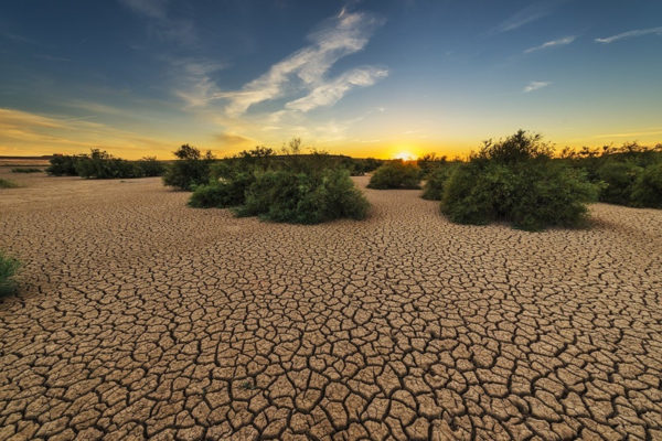
Drought is one of the most serious natural disaster to affect society and the environment in the world. Despite the advances in research on the occurrence, trends and uncertainties about the global frequency of drought events, this phenomenon has caused more than half of all deaths from natural disasters globally during the twentieth century.
After the floods, drought is considered the natural disaster with the second level higher level of human impacts . According to the Office for Reduction of the United Nations Disaster Risk, more than 50 million people were affected by the drought, only in 2015.
In recent decades, there has been a significant increase in the occurrence of droughts in the Latin American and Caribbean region. The mitigation of drought impacts is a key priority for many governments in the region in order to move away from emergency crisis management and proactive work in climate risk management.
The importance of the issue, recently released Atlas Drought in Latin America and the Caribbean , focusing on the frequency of study of the drought events weather impacted the region.
The study was prepared by the Center for Arid and Semi-arid Zones of Latin America and the Caribbean (Cazalac) and the International Hydrological Program of the United Nations Educational, Scientific and Cultural Organization (UNESCO), in collaboration with the Institute of Water Resources the United States Army Corps of Engineers.
To read the Atlas Drought in Latin America and the Caribbean, click here .
The development of the Atlas Drought in Latin America and the Caribbean was started in 2008. In the period of 10 years, regional workshops were held, allowing training in most countries , spreading a consolidated methodology of general application.
The characterization of the drought threat is an important step to allow better management in the region. The Atlas Drought in Latin America and the Caribbean generates a reference to the frequency of the phenomenon.
By generating stronger climate information for decision making, the document directly supports the proactive management of droughts in the region. Also, compiles national experiences of 10 countries (Argentina, Bolivia, Brazil, Chile, Colombia, Ecuador, Honduras, Peru, Uruguay and Venezuela), with regard to the impacts of drought, the recurrence of the phenomenon, but also the political and adaptation measures to address the threat.
The national case studies understand the causes and characteristics of drought events , including its processes in order to identify the vulnerability of livelihoods to the dangers of drought.
In the document, experts have adopted an innovative methodology that identifies the variability of rainfall reduction in Latin America and the Caribbean, allowing you to see how this differs climate variability spatially within countries, even over short distances. This is achieved by identifying the frequency of drought , which is the probability of occurrence of the phenomenon with a certain magnitude and duration, anywhere in the area of interest.
regional challenges to water security
The Atlas also highlights the impact of drought on water resources, analyzing capacity to respond to major challenges local, regional and global challenges to water security. The development of innovative solutions and activities that contributed to the development of the Atlas supported the dissemination of knowledge for the active management of water. The document is also a step to the establishment of systems for monitoring and prognosis of drought , to strengthen the proactive management of the phenomenon in the region.
Experts highlighted an obvious contradiction in drought management. Despite all the technological advances that allow to have new water sources and more efficient in their use, such as the use of groundwater, seawater desalination or water recycling, water scarcity remains a threat to the well- human being.
Several countries still suffer from migration, hunger and diseases associated with temporary water shortages. Their economic systems are also, in many cases, strongly affected. This can also generate political instability, because the solutions to these problems are not, in many cases enough.
According to the director of Cazalac, to deal with this phenomenon, the answer is to anticipate , to know in advance which adaptation measures should be implemented and which can be applied, so that the impact of drought can be controlled.
For this, the monitoring and alerting tools are fundamental to allow better planning of the economic and social sectors and better management of drought.
drought frequency in Brazil
The Analysis Laboratory and Satellite Image Processing (Lapis) was the focal point responsible for the conduct of studies on the drought in Brazil and prepared one of the members of the Atlas chapters.
The Lapis carries out continuous monitoring of drought in Brazil , through remote sensing technology, having developed methodologies, software, tools and specific satellite products to provide operationally radiography droughts in Brazil. These tools are essential to planning and decision making on the management of drought.
In Atlas of drought , the authors showed how the drought has been a problem common to all regions of Brazil , with the Brazilian semiarid region where there is the most chronic situation of water scarcity.
Based on the book “A drought century: why water policies not transformed the Semi-Arid” , experts analyzed the history of droughts in Brazil, identifying and evaluating the answers given by governments in terms of policies and adaptation actions according to the severity of each weather event. Also highlighted were the lessons of the drought that hit the region during the period 2010-2017, considered the worst drought of the century. To purchase the book “A drought century”, click here.
In the chapter of the Atlas of Brazil, also were discussed the drought impacts on different economic sectors , the frequency of extreme drought in Brazil and institutional management of disaster risk by drought in Brazil.
innovative methodology Atlas Drought
.png)
The methodology Drought Atlas is based on a statistical approach called “Regional Frequency Analysis using moments L (ARF-LM).” The project contributed to the development of a software open source for the calculation of Regional Frequency Analysis, using L moments, and resulted in a set of different and affordable software programs . These tools allow us to analyze various climate indices, identifying modes of climate variability to affect a particular region of interest.
The code generated to develop maps of Brazil , using Analysis of Regional Frequency, based on L moments (RFA-LM), is available in Lapis .
The RFA-LM method is more suitable for the study of regions with significant interannual variability and short data series.
The L moment the approach is designed to better estimate the distribution from a limited number of observations.
One of the first applications of the methodology was the Atlas Drought of the United States in 1993. In this pioneering study, the L moment of approach has been enhanced with a regionalization approach. This regionalization allows you to combine sets of observations of different stations to determine a common distribution over a larger area.
This is very useful when most stations have short records , which is typical for dry land areas. Significant improvements were made to the original methodology to allow its application in regions of Latin America and the Caribbean, which have high climate variability, combined with limited measurement data available.
For each country, three different maps were created: the frequency of droughts is presented as a set of maps , with return periods associated with drought intensities, expressed as rainfall deficits.
This method was especially relevant in drylands where: the number of weather stations is limited; the data sets are short and incomplete; there is high variability in annual rainfall; the weather is often influenced by large-scale extreme events such as El Niño Southern Oscillation (ENSO).
In the figure above, a specific analysis was done for the city of Barra de São Miguel. To interact with the map, select your county or state in Brazil and receive the rainfall volume data expected for different periods of time. The platform is available at this link .
Conclusion
The methodology used in the Drought Atlas preparation provides an efficient tool for the study of the frequency of droughts in Latin America and the Caribbean. The drought frequency study identifies how climate variability differ spatially within each country. Thus, the Atlas Drought provides an effective tool to raise awareness about exposure to drought in Latin America and the Caribbean.
The document also presents an X-ray of the institutional management of droughts in the region , allowing the adoption of drought management measures.
And you believe that scientific drought frequency analysis allows a better preparation and management of the impacts of the phenomenon?
Atlanta, November 25, 2018
Original text by our partner “Letras Ambientais”.
https://letrasambientais.com.br/posts/atlas-da-unesco-mostra-frequencia-da-seca-na-america-latina-e-no-caribe